
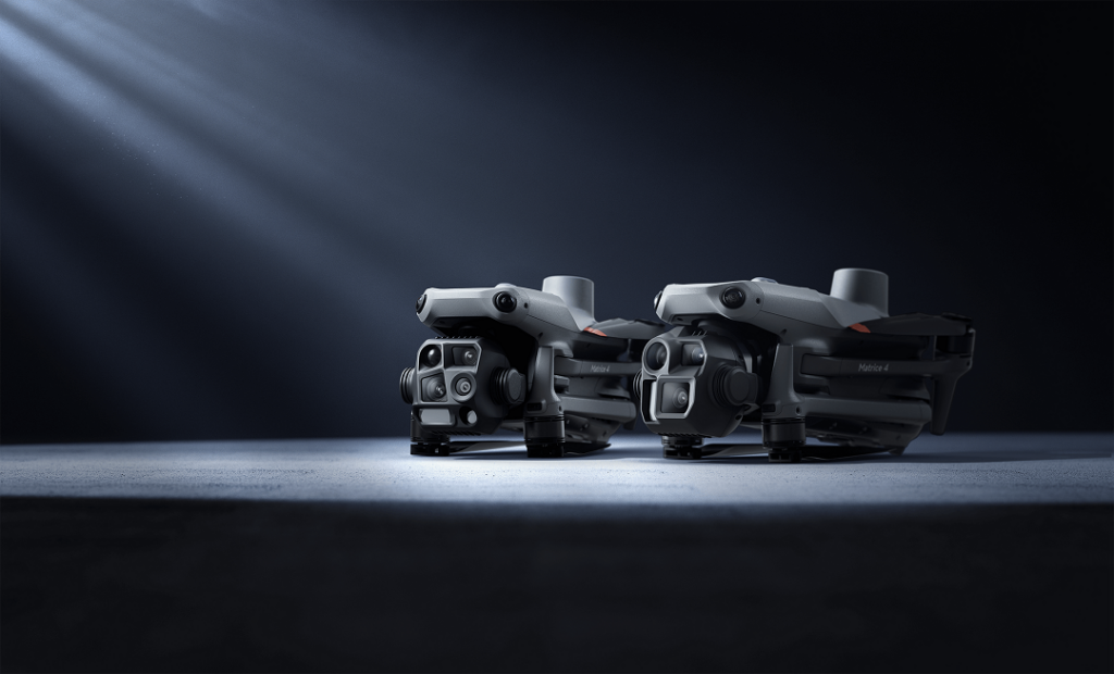
Aerial Field Services prides itself on using top-of-the-line drone technology and equipment to deliver our services. Our fleet currently features three cornerstone drone platforms: the DJI Agras T50, (COMING SOON) the DJI Mavic 4 (Enterprise series), and DJI Matrice 4T series models. Each of these drones has unique capabilities and roles, chosen strategically to align with AFS’s goals of efficiency, precision, and safety. In this section, we provide an in-depth breakdown of each platform – what it can do, how we use it, and why we chose it – as well as highlight the overall benefits these drones bring to our clients.
Agricultural Powerhouse
When it comes to agricultural drone services, the DJI Agras T50 is our go-to machine. This drone is an agricultural spraying powerhouse, purpose-built for tasks like crop spraying and spreading fertilizers or seeds. Here’s what makes the Agras T50 stand out.
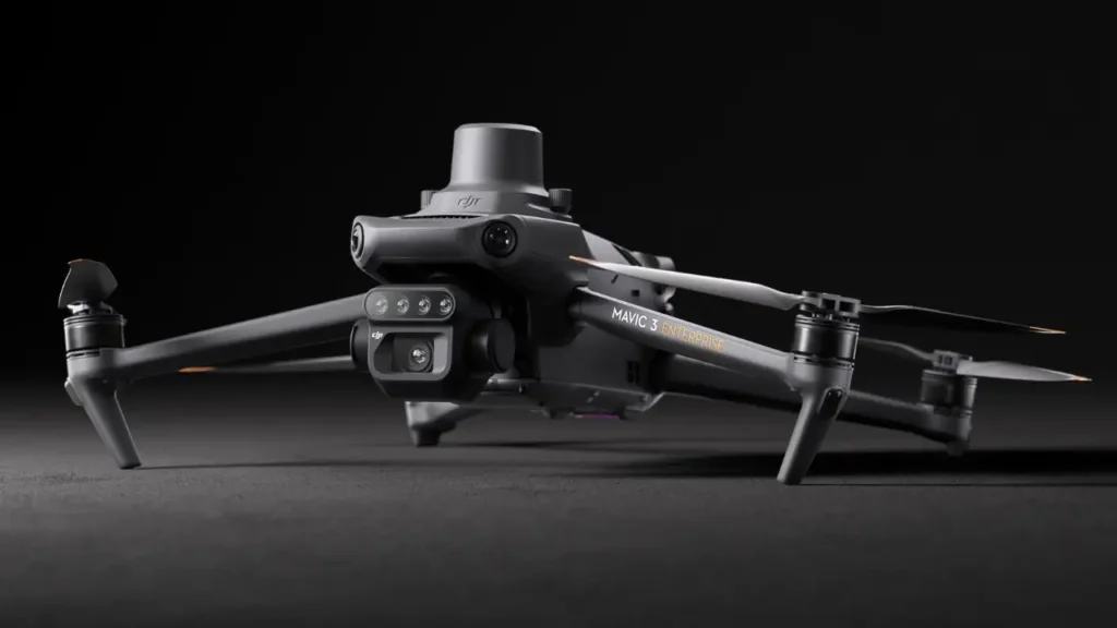
The Versatile Mapper and Scout (COMING SOON)
For our mapping, surveying, and inspection tasks, the DJI Mavic series drones have been indispensable, and we’re gearing up to utilize the DJI Mavic 4 Enterprise as the next evolution in this lineup. The Mavic series is known for packing professional capabilities into a portable form factor.
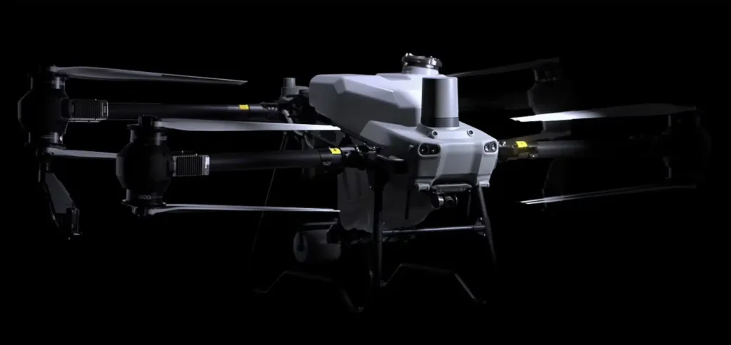
Industrial-Grade Workhorse (COMING SOON)
For the most demanding and specialized tasks, we rely on the DJI Matrice series drones, particularly the Matrice 300 RTK, which is an industrial-grade platform loaded with features for enterprise use.
Having these three tiers of drones – Agras T50, Mavic 4, and Matrice 4T – means we can always deploy the optimal tool for the job. Here’s how this strategy benefits our clients
We won’t use an overkill solution that might cost more or take longer. For instance, if a client needs a quick 20-acre map, sending the Mavic is more efficient than the larger Matrice. Conversely, if a client needs 500 acres surveyed in a day, the Matrice can do that in fewer flights than a Mavic, saving time. Our diverse fleet ensures we match the tool to the task, optimizing time and cost.
Each of our drones provides professional-grade data. Because we invested in high-end models, clients get deliverables that are sharp, accurate, and reliable. The choice of DJI also means the data pipeline (from drone to processing software) is smooth and standardized, reducing errors. For example, using the RTK on both Mavic 4 and Matrice means the maps we produce have survey-level accuracy , which can eliminate the need for additional ground surveys.
With multiple drones, we have redundancy in our operations. If one drone (rarely) has an issue, we can often deploy another to complete the mission. We often bring a backup drone to critical jobs. This ensures minimal downtime and that we can meet client deadlines even if unforeseen equipment issues arise. Also, certain jobs might even use multiple drones simultaneously (e.g., two Mavics mapping different parts of a large site to finish faster). We can scale our approach as needed.
All our DJI drones have geofencing and safety features that help prevent accidental airspace incursions, and we can unlock them with proper clearance when we have authorization. They also have return-to-home functionality on battery low or signal loss. These features protect the equipment and the work. Plus, our pilots are well-versed with each platform’s fail-safes and limitations, thanks to our focus on training with the specific models we operate.
While the drones are the stars, our equipment suite includes supporting technologies that ensure we get the most out of these platforms:
We utilize the Zenmuse H20T camera on the Matrice (a quad-sensor gimbal with zoom, wide, thermal, rangefinder) – this all-in-one payload exemplifies high tech, letting us transition from a 20× zoom inspection to a thermal scan instantly . For ultra-high resolution mapping, we have access to the Zenmuse P1 (45 MP full-frame camera) that pairs with the Matrice 300, capturing images that result in incredibly detailed maps and models, suitable for surveying or precision inspection (like detecting fine cracks in infrastructure from the 3D model).
We use DJI Terra for flight planning and initial processing, Pix4D for advanced photogrammetry, and specialized software for tasks like thermal analysis or 3D modeling. Our drones integrate with these tools – e.g., the Agras T50 works with DJI Terra to take the mapping data and create spray plans. We also use flight planning apps that allow terrain follow and complex waypoint missions, leveraging each drone’s capabilities fully (for instance, programming the Mavic 4 to do a grid at two different altitudes: one high for an orthophoto and one low for oblique angle shots for a 3D model).
For the highest accuracy jobs, we deploy RTK base stations or use network RTK corrections to supplement the drone’s onboard RTK. This ensures that even if the drone loses a connection to the correction stream, we have local data to correct the flight logs. For clients requiring certified survey results, we have workflows to incorporate surveyed ground control points and validate our outputs against them, ensuring that our deliverables meet required standards.
We maintain a stock of spare parts (propellers, pumps for the Agras, motors) and have diagnostic tools to run regular checks on our drones. Downtime is minimized because we can repair or tune equipment in-house quickly. We follow manufacturer maintenance schedules for components like batteries (e.g., the TB60 batteries for Matrice are cycled and monitored for health). This rigorous maintenance regime means our drones perform at their best on every job.
In conclusion, our arsenal of drones – the DJI Agras T50, DJI Mavic 4 Enterprise, and DJI Matrice 4T (Or comparable model) – is carefully chosen to cover the full spectrum of drone services. This multi-platform approach is a cornerstone of Aerial Field Services’ strategy to be a one-stop solution for clients. By having the right equipment, we ensure that whether it’s a farmer wanting a precise spray, a construction manager needing a survey, or an energy company requiring an inspection, we have the ideal tool ready. Our investment in these drones is an investment in the quality, safety, and effectiveness of the solutions we provide to you. It’s how we bridge cutting-edge technology with real-world applications – giving you the advantages of the latest drones without the hassle of owning or learning them. We handle the tech; you reap the benefits.
© 2012–2025, aerial field services. All rights reserved.